
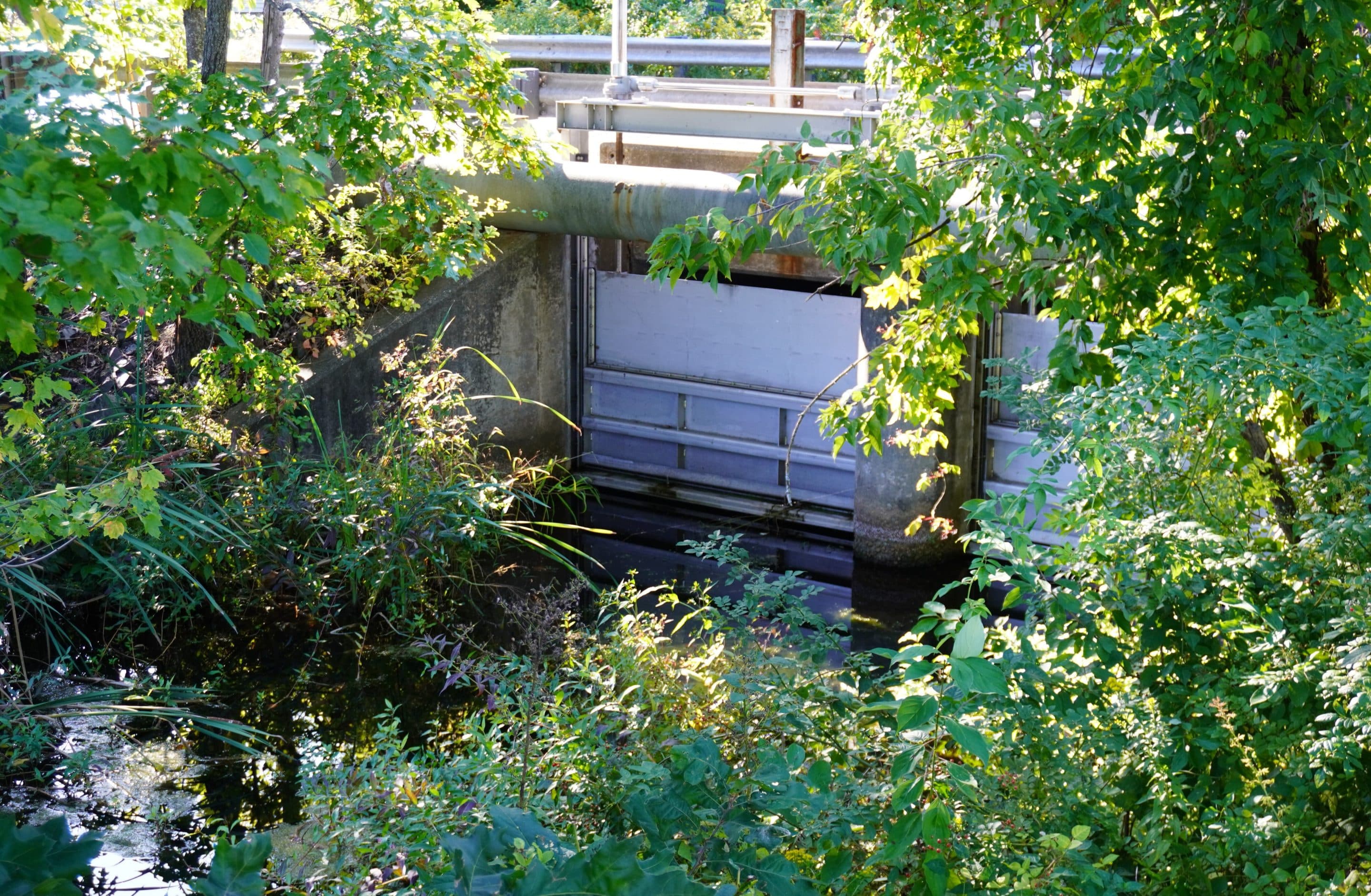
At the Conservation Commission meeting on May 18, four options to mitigate flooding on the Great Ponds of Congamond Lakes was announced. Each would include this weir gate, which is along Berkshire Avenue, being raised nearly a foot and a half.
Reminder Publishing submitted photo
SOUTHWICK — Conservation Commission Chair Norm Cheever announced at its meeting on May 18 that four alternatives have been developed to mitigate flooding events at Congamond Lakes, and he said the costs range from $3 million to $222 million.
“We’re discussing the alternatives, the pros and cons, and then we’ll move into the design phase,” Cheever said about the alternatives.
In December 2022, the Lake Management Committee asked the Natural Resources Conservation Service for options that would protect the ponds and the properties along the shore in the event of a 100-year storm, which theoretically means a flooding event that raises the level of a body of water between 1 and 3 feet, and has a 1% chance of occurring annually.
The NRCS, using only readily available geological and watershed and photographic data, issued a report in June 2023.
The NRCS proposed four options, including one that involved doing nothing. Two options were characterized as structural solutions, which called for the building of an outlet pipe in North Pond and replacing the culverts that allow water and boat traffic to move between the three ponds with roadway bridges.
The fourth option was considered “non-structural.” It involved purchasing and demolishing the 79 homes on properties identified as at risk of flooding in a 100-year storm. The current residents would have to be relocated.
At the Conservation Commission meeting on May 18, Cheever discussed four alternatives that were developed using the NRCS options as a guide and what technicians with Holyoke-based Pare Corporation, which was contracted by the NRCS, found during a “boots on the ground” survey.
Alternative 1 has a goal of limiting the amount of backflow into the ponds. That would be accomplished by replacing the Canal Brook and Great Brook weir gates with an automated control structure.
It also includes regrading 2,600 linear feet of the rail trail and raising it 3.5 feet.
Lake Management Committee Chair Richard Grannells said on May 19 that a portion of the rail trail could be breached by a flood, but he shared that has never happened before.
The estimated cost of Alternative 1 is between $3 million and $6 million, according to the PowerPoint slide shown by Cheever during the commission meeting on May 18.
Alternative 2, which includes the alterations proposed in Alternative 1, involves an alteration to Canal Brook, which includes dredging it for 6,000 linear feet, removing 50,000 cubic yards of earth, lowering its bed by up to 3 feet and widening it between 10 and 25 feet.
It also includes replacing the bridge crossings at Quarry, Notch, Brookside, Griffen and Phelps roads, as well as two access points on the Rail Trail.
The estimated cost of Alternative 2 is between $53 million and $88 million.
Alternative 3 would alter Great and Canal Brook by using the alterations proposed in Alternatives 1 and 2. This includes altering 15,000 linear feet of Great Brook that would involve clearing woody vegetation, lowering the stream bed by 3 feet, and widening it by up to 22 feet. It also means replacing the crossings at Sheep Pasture, South Longyard, Feeding Hills, Shaker roads and Industrial Drive.
The estimated cost is between $135 million and $222 million.
Cheever said Alternative 2 and 3 wouldn’t give the town the “big benefit we were hoping to get.”
He said elevating the bed of Canal Brook wouldn’t provide the outflow needed.
Alternative 4 would include the alteration in Alternative 1. It would mean a 6-foot outlet on North Pond and a weir gate at the outlet would be installed at an estimated cost of between $9 million and $15 million.
For thousands of years, North Pond had a natural outlet, and geological maps of North Pond in the late 1800s and early 1900s show where that brook carried water out of Congamond Lake, which is in the area of the cul-de-sac on North Pond Road. However, at some point, the brook was “plugged.”
It remained plugged until Hurricane Diane swept through in 1955 and dumped nearly 2 feet of rain over the area. During the deluge, Great Brook was measured at 100 feet in width, according to news reports at the time.
Cheever also proposed a fifth alternative, which would mean the installation of a conduit from the ponds into the Great and Canal brooks. The town would also pump the ponds’ water out.
The point of the alternatives is to have the water in the ponds flow out of the Canal and Great brooks. This is how the ponds maintained their water quality for 14,000 years.
Over the decades, the brooks have become so thick with dead vegetation that the ponds’ water doesn’t escape during a rain event, but flows in, which affects water quality by pushing sediment into the ponds.
Grannells was asked who would make the decision about which alternative is the best solution for potential flooding.
He said the four alternatives would be studied by the NRCS and the U.S. Department of Agriculture, and the pros and cons of each would be thoroughly examined. He added that there will be an explanation of why a specific alternative is chosen. For the three not chosen, detailed explanations as to why would also be included in the final recommendation.
It was announced at the commission meeting that LMC member Eric Mueller believes Alternative 1 is the best solution.
Whichever alternative is approved, the federal government would pay the cost for planning and design, but as the “sponsor” of the project, the town would pay 35% of the construction costs.